


Air Traffic Control Zones
Air travel is a great thing about living in the present times. Many centuries ago, people only dreamed of flying from place to place, but now we have Wi-Fi aboard the airplanes. Here’s a map showing air traffic control zones over the US.
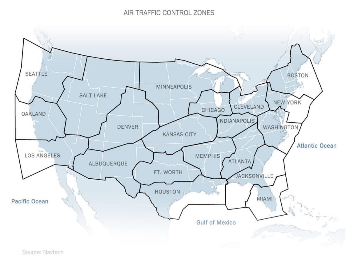
Air Traffic Conrol Zones
States Resized Based on Population Density
People often forget how vast the United States actually is because they look at states individually. With this map, you can see each state resized based on its population density. That explains the electoral vote distribution, too.
ADVERTISEMENT
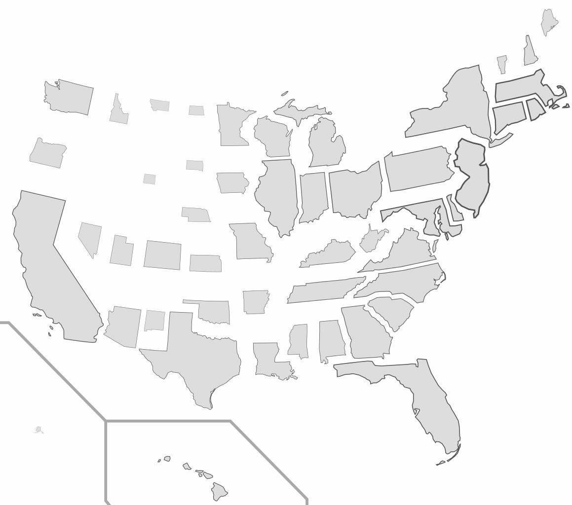
States Resized Based On Population Density